


Center Precinct 2, Norton County, Kansas
About
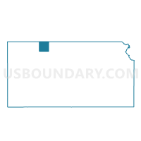
Outline

Summary
| Unique Area Identifier | 586146 |
| Name | Center Precinct 2 |
| County | Norton County |
| State | Kansas |
| Area (square miles) | 133.12 |
| Land Area (square miles) | 132.98 |
| Water Area (square miles) | 0.14 |
| % of Land Area | 99.89 |
| % of Water Area | 0.11 |
| Latitude of the Internal Point | 39.90862640 |
| Longtitude of the Internal Point | -100.07168510 |
Maps


Graphs
Select a template below for downloading or customizing gragh for Center Precinct 2, Norton County, Kansas


Neighbors
Neighoring Voting District (by Name) Neighboring Voting District on the Map
- Center Precinct 1, Norton County, KS
- Garfield Township Voting District, Decatur County, KS
- Grant Township Voting District, Decatur County, KS
- Hendley Precinct, Furnas County, NE
- Highland Precinct 2, Norton County, KS
- Highland Precinct 3, Norton County, KS
- Lincoln Township Voting District, Decatur County, KS
- Wilsonville Precinct, Furnas County, NE
Top 10 Neighboring County Subdivision (by Population) Neighboring County Subdivision on the Map
- Center-District 1 township, Norton County, KS (1,393)
- Highland-District 2 township, Norton County, KS (604)
- Lincoln township, Decatur County, KS (172)
- Wilsonville precinct, Furnas County, NE (168)
- Hendley precinct, Furnas County, NE (161)
- Garfield township, Decatur County, KS (42)
- Grant township, Decatur County, KS (11)
Top 10 Neighboring Place (by Population) Neighboring Place on the Map
Top 10 Neighboring Unified School District (by Population) Neighboring Unified School District on the Map
- Norton Community Schools Unified School District 211, KS (4,473)
- Oberlin Unified School District 294, KS (2,808)
- Southwest Public Schools, NE (2,093)
- Cambridge Public Schools, NE (1,550)
Top 10 Neighboring State Legislative District Lower Chamber (by Population) Neighboring State Legislative District Lower Chamber on the Map
Top 10 Neighboring State Legislative District Upper Chamber (by Population) Neighboring State Legislative District Upper Chamber on the Map
Top 10 Neighboring 111th Congressional District (by Population) Neighboring 111th Congressional District on the Map
Top 10 Neighboring Census Tract (by Population) Neighboring Census Tract on the Map
- Census Tract 9517, Norton County, KS (5,671)
- Census Tract 9639, Furnas County, NE (4,959)
- Census Tract 9511, Decatur County, KS (1,104)